Description:
195 yards of RIVERFRONT property on the McKenzie River in Lane County, Oregon. Need I say more?
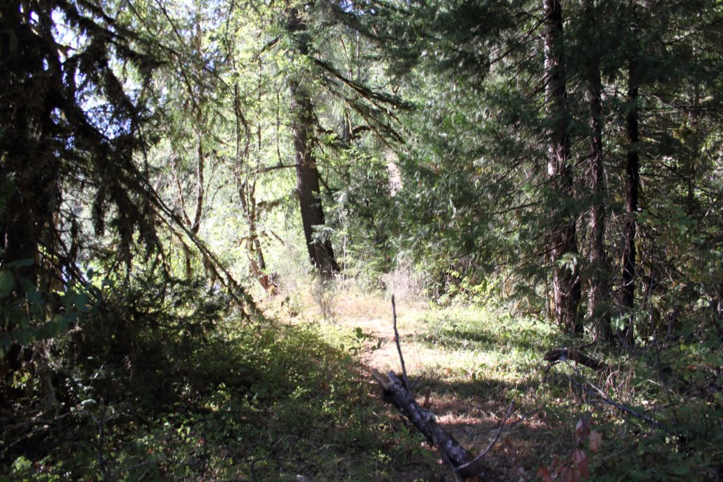
Imagine waking up to views of beautiful trees, foliage and mist rising off the water. This site offers a breathtaking vista of the McKenzie River Valley, Cascade mountains & Cougar Reservoir. The easy road access offers convenience, while the location lets you enjoy your private space and RIVERFRONT land! Fish, camp, and enjoy mother nature on your private parcel.
How often do you find a waterfront real estate at a price we’re listing it for? Go grab it now and enjoy a peaceful, restorative place to come home to or spend the nights camping on the banks of the McKenzie River.
Note: Since Wilco Land had photographs taken of this property, it has been burned in the McKenzie Fire. This is definitely a bummer BUT it’s still riverfront land in Oregon with a ton of recreation available all around you! It’s also an opportunity to develop the property exactly how you envision it. Sooner than you know it, this area will be recovered from the fire and the property will be too.
Property Details:
Acreage: 0.38
County: Lane
State: Oregon
Parcel ID: 16-45-24-00-00500
Google Maps: http://www.google.com/maps/place/44.166761,-122.267196
Zoning: F2 Zone
View County/Property Zoning Info Here: https://lanecounty.org/government/county_departments/public_works/land_management_division/land_use_planning___zoning
Annual Taxes: $24.43
Access Notes:
Access is easy via Center CPS Coords via google maps or GPS. The device will have you stop along HWY 126 but just go a bit further to Cougar Dam Rd. and turn right then take the first right with the sign for the boat launch, the property starts at the end of the pavement. See Youtube Video for a more detailed explanation
Terrain Notes:
RIVERFRONT
Utilities Notes:
Undeveloped/vacant land
Download our property brochure for more information, including zoning, camping, RV, and building info!
Location Details:
Use this link to view the parcel outline on Google Earth/Maps: https://drive.google.com/file/
- Center Coordinates: 44.166761, -122.267196
- NW Corner: 44.167544, -122.268335
- NE Corner: 44.166977, -122.266866
- SE Corner: 44.166150, -122.266827
- SW Corner: Property has irregular shape.
- Approximate Address: No Situs Address
Don’t know how to use GPS coordinates? Here’s a quick tutorial I made: link
Contact Liz Rosaldo at 605-667-5474 or email [email protected]
Our customers partner with Wilco Land for their land investments, because we’re different from other land sellers. We offer:
- Seller financing: Low down payments, flexible terms, and no credit checks
- Education and guidance: Free 1-on-1 consultation, property videos, educational blog posts, training, and market reports to give you the knowledge and confidence to make the right land investment.
- You can grow with us. We offer a land upgrade program, referral program, and more than one person has made money flipping our properties.
*This information is reliable but not guaranteed. Neither Wilco LLC or it’s associates are responsible for the accuracy of this information. Customers are responsible for all necessary due diligence pertaining to a purchase. Rural, undeveloped land can be dangerous due to terrain, poor or non-existent road access, etc. and calls for caution when visiting. Wilco will not be held responsible for any action or outcomes by visitors to our property.


Leave a Reply