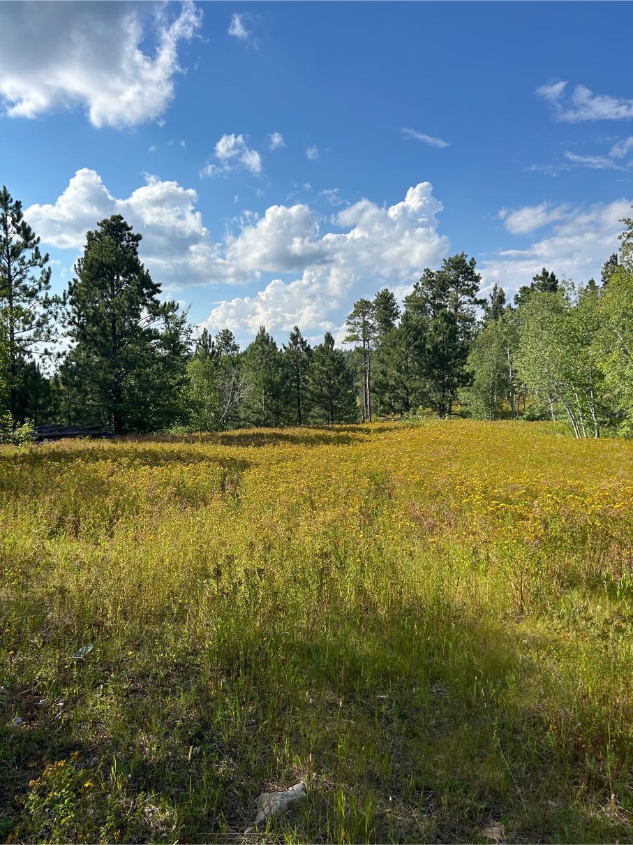
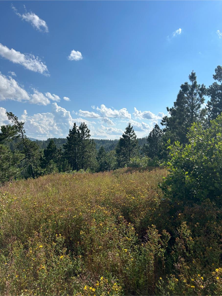
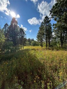
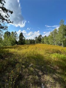
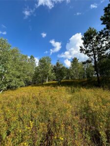
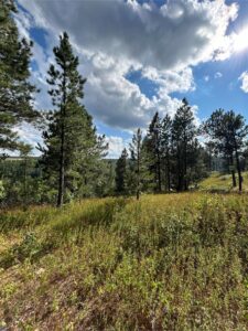
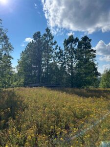
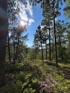
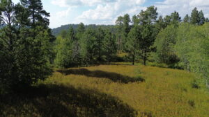
Description: Unlock the ultimate outdoor playground with this 27-acre lot in Spearfish, South Dakota! Whether you’re a hunter, camper, or seeking a remote cabin to escape to in the hills, this property offers unmatched freedom, privacy, and breathtaking views. Located right behind Terry Peak Ski Area and adjacent to the stunning Black Hills National Forest, this land provides endless opportunities for recreation!
The 27 acres are actually divided into two legal 13+ acre lots, giving you the flexibility to sell one, keep both, or even gift one to a friend or family member, enhancing the overall value of this unique property.
Enjoy uninterrupted views and open spaces for building or camping, all while having easy access to the natural wonders of the Black Hills. As a bonus, the property includes a camper from the previous owner, providing immediate convenience for those eager to start enjoying their new land right away.
Don’t miss out on the chance to own a unique piece of the Black Hills with endless potential for recreation, relaxation, and future returns!
PS I (Miles) have personally gone to this property and I loved it. It’s hard to sell land like this because I wish we could keep it! A lot of flat areas, great views and just a sweet location behind Terry Peak and adjacent to Black Hills National Forest. A great hunting location and spot for a cabin. Fun drive to get back to it too, very private.
Property Details:
- Acreage: 27.40
- County: Lawrence
- State: South Dakota
- Parcel ID: 26580-01376-000-91 and 26580-01376-000-89
- Google Maps: Click here
- Zoning: PF Park Forest District
- Land Use / Zoning Summary: PF Park Forest District
- County Zoning Contact Info:
- Website: Click here
- Phone Number: 605-578-3871
- View County/Property Zoning Info Here: Click here
- Annual Taxes: $732.76
- Access Notes: There is access from Richmond Hill Rd. Go right by Terry Peak onto Richmond Hill Road. There are easements in place and I personally have driven to this property. There is a gate I have codes to, so people who want to view will need to contact us and get that information or view with our realtor.Using Onxmaps makes access easy.
- Plan your route before you go. We recommend using the GPS coordinates and an app like OnxMaps (see our blog for a tutorial), County GIS maps, our Google Earth map link and Satellite images to map out potential access routes before visiting.
- Be safe when visiting! Rural, undeveloped land can be dangerous due to terrain, poor or non-existent road access, etc. and calls for caution when visiting. Tell someone where you are going and when you will return. Remember, to respect local landowners and laws. Do not trespass. Ultimately, you, the customer, are responsible for identifying access through due diligence. Wilco will not be held responsible for any actions or outcomes by visitors to our property.
- Utilities Notes:
- Power/Electric Info: For those inquiring about electricity/power. There are nearby power lines and access to power. It looks like Butte Electric Cooperative and/or Black Hills Energy both may service this area. See attached maps: Click to view – Buyer to verify all information regarding utilities.
- Well Info: We have researched well logs in the area and see the following recorded well logs. I have made a folder with a few nearby well logs and corresponding photos of the well location on a GIS map here: Click to view
– You can search well logs in the state of South Dakota using this site: https://apps.sd.gov/
nr68welllogs/ – Simply search the Township Range Section of subject property, which is: 005N, 002E, 10 (or just zoom in and find the area on the interactive map) and look for nearby wells in the area. You can click for the recorded well log from there. – For those curious, you can find more wells listed on the above website further out than the ones I shared and you can contact local well drillers to pick their brains.You can see who completed the wells, from the well logs, in the folder I linked above or from the SD website I shared with you above.
- Camping: RVs and camping allowed.
- Mobile Homes: Mobile homes are allowed.
Location Details: Use this link to view the parcel outline on Google Earth/Maps: Click here
- Center Coordinates: 44.407071, -103.852673
- NW Corner: 44.408297, -103.854577
- NE Corner: 44.408409, -103.849986
- SE Corner: 44.405601, -103.850848
- SW Corner: 44.405489, -103.855267
Don’t know how to use GPS coordinates? Here’s a quick tutorial I made: link
- Wilco reserves the right to approve or deny any proposed installment payment plans.
Ready to make a land investment? Call or text Miles McLaughlin at 605-250-1256 or miles@wilcolandllc.com to learn more or make a purchase.
Interested in learning more about due diligence, zoning, county websites/resources, and about us? Check out our blog page here: https://wilcolandllc.com/blog/
Our customers partner with Wilco Land for their land investments, because we’re different from other land sellers. We offer:
- Seller financing: Low down payments, flexible terms, and no credit checks
- Education and guidance: Free 1-on-1 consultation, property videos, educational blog posts, training, and market reports to give you the knowledge and confidence to make the right land investment.
- Discounted and below market cash deals!
- You can grow with us. We offer a referral program, and more than one person has made money flipping our properties.
*This information is reliable but not guaranteed. Neither Wilco LLC or its associates are responsible for the accuracy of this information. Customers are responsible for all necessary due diligence pertaining to a purchase. Rural, undeveloped land can be dangerous due to terrain, poor or non-existent road access, etc. and calls for caution when visiting. Wilco will not be held responsible for any action or outcomes by visitors to our property.






Contact Us About This Property